Location Intelligence Data 

Nov 14, 2023

Location Intelligence Data 

Blog

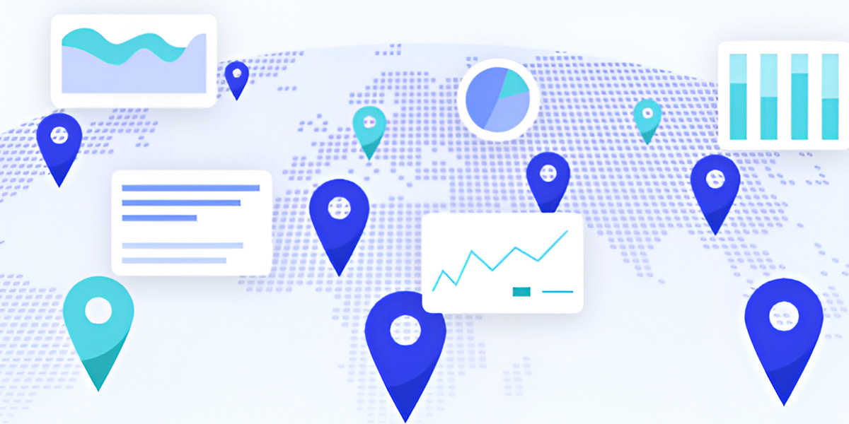
Technology is transforming the way companies are growing. Location data intelligence is valuable geographic information collected by sophisticated technologies and software platforms to aid businesses in problem-solving and planning. dataplor is the leading location intelligence service provider trusted by some of the world’s foremost companies. 

What Is Location Intelligence? 

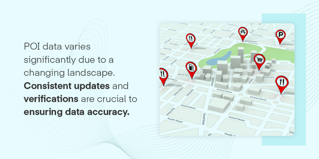
Location intelligence is the knowledge gained by analyzing geospatial information collected from geographic information systems (GIS). Using satellite imaging, drones and census reports streamlines collection procedures to gather addresses, coordinates and spatial data. Businesses use this information to develop a thorough understanding of their points of interest (POIs), creating multilayered visualizations to empower decision-making procedures. They study patterns, relationships and trends to understand the current climate, predict future characteristics and identify potential business opportunities. 

A complete list of data points that can support your POI data are: 

  • Demographics 
  • Weather 
  • Environment 
  • Economy 
  • Geographies 
  • Behavior 

Applications of Location Intelligence Solutions 

Location data holds the key to unlocking a smarter way to do business. With the growing utilization of technology and sensors, organizations can collect detailed information about a region to get more insight into how to optimize their business strategies for success. Sectors like retail, insurance, real estate and health care are among the industries that leverage location intelligence solutions to facilitate informed decision-making and maximize revenue. 

Some common uses of this type of information include: 

  • Mapping: Geospatial data enables professionals to create easy-to-understand visualizations to identify patterns and potential relationships within and between locations. 
  • Consumer insights: Location-based marketing intelligence can teach businesses more about how POIs will perform, what products will become popular and how consumers will interpret marketing efforts.
  • Site selection: Location insights allow organizations to weigh the pros and cons of potential retail locations to find a space that sets their business apart from the rest. 
  • Competitor investigation: Gain a deep knowledge of the competition to identify market opportunities and minimize risk. 

Acquire Location Insights From dataplor

dataplor is a leading provider of location intelligence that your business can count on. We understand the impact that high-quality data can have on a business and strive to make that information more accessible than ever. Our service is supported by advanced machine learning, image recognition and artificial intelligence technologies. These tools examine a vast range of data within more than 250 million locations in over 200 countries to ensure you have the knowledge to grow in countless markets. 

With the dataplor experts by your side, you can trust that the information you’re receiving is accurate and current. We’ve assembled an international team of analysts, human validators and scientists to double- and triple-check our datasets. They leverage their local experience and language fluency to identify duplicates, reduce errors and catch inaccuracies. Collect our real-time data that combines hundreds of sources to ensure your judgments are reliable. 

Reach out to Our Experts for More Information 

dataplor is a location intelligence company with a global reach to ensure your business has what it needs to maximize its potential. Our industry-leading quality control procedures ensure you receive highly accurate and relevant location data intelligence you can trust. 

Partner with a provider committed to delivering the best data on the market. Contact our experts online to learn how our service can strengthen your business strategies. 

Global Places Dataset

Nov 14, 2023

Global Places Dataset

Blog

Data makes the world go round. Sourcing consistent and precise streams of geographic information is crucial to enhancing your planning and decision-making procedures. On your own, this task can seem daunting and require significant investments of time, energy and resources. Instead, working with a trustworthy geographic data provider can streamline your operations and get you back to focusing on the areas of your business that need your attention.

dataplor is a world-leading data provider known for delivering premium global market insights to help businesses optimize their operations. Our meticulous attention to detail and commitment to verifying our data will place our services at the top of your list. We give you what you need to learn more about the world and make decisions that propel you toward success. 

All the Information You Need Is at Your Fingertips

Don’t risk your global efforts with outdated or incomplete data. dataplor seeks to give you an in-depth representation of the world around you using thorough collections of global market insights. We collect data from more than 250 million locations in 200 countries and territories, giving us one of the largest data coverages in the world. Our places datasets are constantly growing with point of interest (POI) information complete with detailed metadata, making it easy to find the data you’re looking for. 

Our experts leverage advanced technologies to support our work, including image recognition, artificial intelligence and language models. These tools help us collect a wide range of information regarding consumer behaviors, statistics and geographic information tied to locations and brands. Gain more information about your POIs without sacrificing your time, leaving all the heavy lifting to dataplor. 

Trust High-Quality Global Places Data 

Optimize your global market insight with information you can trust. At dataplor, we understand how vital your data quality is to your business and strive to provide a comprehensive solution. Our global places datasets are updated in as close to real-time as possible through our advanced machine-learning capabilities. This ability allows us to provide companies with an exhaustive supply of billions of detailed data points to fuel business strategies.

dataplor has built a state-of-the-art quality control system to foster the reliability you deserve. We constantly validate data to identify duplicates and resolve discrepancies through AI-driven automation and an in-house team of highly trained experts, scientists and analysts. Our professionals are positioned worldwide, leveraging their local expertise and language proficiency to review data and flag errors. Approach new investments and expansions confidently while knowing you’re tackling every decision with a stockpile of accurate data. 

Get Started With Our Service Today

Partner with a leading geographic data provider to maximize your business’s potential. At dataplor, we have years of experience working with companies of all shapes and sizes, providing unrivaled information to fuel successful decision-making and problem-solving activities. Our large global places datasets offer valuable metrics your business can use to satisfy customers, scale your operation, and take advantage of unique market opportunities. 

Contact dataplor online to find the answers to all your questions and discover how our service can assist your business.

Guide to Point-of-Interest Data

Nov 01, 2023

Guide to Point-of-Interest Data

Blog

When businesses need to make location-based decisions, they often turn to point-of-interest data. POI is the backbone of many modern tools and data sets, so high-quality data is crucial, but gathering this information can be challenging. Understanding how to collect and compile POI can help you make informed choices when obtaining and using the data for your organization.

What Is POI Data?

Points of interest are any attraction or service people may find exciting or valuable. Some points-of-interest examples include businesses, historical landmarks, parking lots, ATMs, and churches. You access POI data whenever you use a navigation app to get directions on your phone. It shows where these places are and can include metadata with more information, such as the type of business.

Point-of-interest data, meaning compiling this information into a large data set, informs many diverse business processes. Also called place data, POI data usually derives from geographical coordinates. The locations can be permanent, like landmarks and buildings, or temporary, such as a music festival or pop-up restaurant.

Most POI data uses the North American Industry Classification System to identify industry sectors. Business, research, and government applications use NAICS codes. These can tell you if a listing is for a gas station, a retail store, a theater, or something else. When you look at a place listing, this standardized code helps quickly identify its purpose.

How Is POI Data Used?

Businesses use POI in myriad ways, from creating routes to analyzing the competition. POI data can be crucial to location-oriented operational tasks, particularly when combined with GPS tools and geofencing capabilities. Here are a few common ways different industries leverage POI data.

  • Telecommunications: The telecom industry heavily relies on POI data to offer insights into service coverage and performance. POI data can inform these maps and provide details for new project decisions, such as where to place cellular towers.
  • Finance and insurance: These risk-averse businesses often use POI data to assess different locations. When insuring a new building, they might look into how close it is to a flood zone or an area with high crime rates before determining pricing.
  • Real estate: Since real estate depends heavily on location, POI data often informs decisions like where to build new developments or which listings might meet someone’s needs. For instance, a list of nearby amenities comes from POI data.
  • Consumer applications: POI data informs many consumer uses, like navigation apps or finding nearby businesses.
  • Marketing: Advertisers can use POI data to target specific audiences within an area by leveraging POI data and geofencing.
  • Logistics and transportation: Transportation industry businesses rely on POI data to inform navigation tasks, like planning and improving routes. Most organizations with fleets use POI data, such as logistics providers, waste management facilities, and the postal service.
  • Retail: Retail stores can use POI data to assess new expansions in a specific area, which can help with performance evaluations and trade area analyses.
  • Governments and public services: Governments can also use POI data when evaluating services within an area. They might look for gaps in service offerings or areas where public infrastructure could improve.

POI offers exceptional versatility, especially if incorporated into sophisticated tools designed for these applications.

Where Does POI Data Come From?

With so many business-critical applications, organizations must consider POI data’s source to ensure its quality. Data providers can use varying methods to collect and verify their information. Typical sources include websites, government databases, and human input. These are often prone to errors, such as inaccurate website listings and out-of-date information.

POI data also varies significantly due to a changing landscape. Businesses might close or open, and some owners forget to update their contact details. Buildings and roads are frequently under construction, and areas could get rezoned. Consistent updates and verifications are crucial to ensuring data accuracy.

Addressing these challenges is one of the reasons it’s so vital to find the correct POI data provider. A partner must take steps to verify the information’s accuracy and continuously update it if they find errors or inconsistencies.

Things to Consider When Acquiring POI Data

Getting quality POI means working with a dependable POI provider. If you’ll be working with POI in business, you must consider several aspects of the data and how a company manages it.

  • Accuracy and update frequency: Ask your POI provider how they keep their listings correct and current. For example, at dataplor, we use a proprietary system to collect near-real-time updates. In contrast, some companies only update their systems quarterly or annually.
  • Verification strategies: Similarly, consider how the company verifies its listings. Look for methods like human verification, error detection systems, artificial intelligence, and machine learning.
  • Global coverage: Depending on how you use POI data, you may need global information. Global place data can be particularly challenging to verify due to language differences and limited international resources for United States-based companies. Your POI provider should take special measures for collecting and verifying international data, like enlisting regional experts and using AI data collection. The provider can also simplify global data by using the same data schema for each country.
  • Completeness: A data provider might support detailed attributes for each listing, but it doesn’t help you much if there are many blank spaces. Look for a provider with high fill rates to ensure thorough metadata and insights from each listing.
  • Modern features: Technologies like AI and machine learning have transformed the world of data collection, and a POI provider should use them to help identify errors or collect information.

Dive Into POI Data With the Industry Leaders at dataplor

High-quality POI data is critical as the foundation of many tasks and business decisions. Some of the world’s largest companies use dataplor’s global, dynamically updated location data to make informed choices. We offer unmatched accuracy and coverage, backed by proprietary technologies and local human validation. Enjoy unique insights with qualitative metrics to learn more about consumer behaviors and brands worldwide.

Whether you need to outpace your competition, boost revenue, expand your services, or meet another goal, we can help. Reach out to a data expert today to learn more about dataplor!

How High-Quality POI Data Supports GIS Navigation

Oct 28, 2023 / 5 min read

How High-Quality POI Data Supports GIS Navigation

Blog

Geographic information systems (GIS) have changed how companies from nearly every sector navigate the global market. These systems grant organizations increased competitive intelligence by enabling them to layer, map, manage, and analyze different types of data at the click of a button.

Among the greatest insights made possible by GIS platforms are those rooted in point of interest (POI) data. Having the right POI data is particularly important for two types of businesses: those that provide GIS navigation services (including Google Maps and Apple Maps) and those that leverage such services to make customers’ day-to-day lives easier (think Uber or DoorDash). But how?

In this article, we’ll answer this by first diving into how GIS mapping works. We’ll then discuss how accurate POI data helps companies increase customer satisfaction, avoid costly errors, and scale globally. Along the way, we’ll cover the true costs of bad GIS data and why dataplor is an industry-leading provider of location intelligence for GIS services of all kinds. 

What is GIS?

GIS visually layers one or more datasets so that users can analyze each in isolation or together. In other words, GIS platforms link these layers to a map by combining location data with various forms of descriptive data. 

These maps provide interactive business insights that raw data cannot generate on its own. GIS map layers allow organizations to see and toggle between different relationships, patterns, and geographic contexts found in their data. By analyzing GIS layers in this way, companies can unlock operational know-how and smarter decision making in real time. 

How does location intelligence support GIS platforms?

Though they enable users to visualize more than one type of data, geographic information systems run primarily on location intelligence. This data is the backbone of GIS mapping, since it allows these systems to feature layers focused on specific geographic contexts. 

For example, a GIS map could contain a polygon layer for France, an additional one for Paris, then yet another for popular tourist and shopping neighborhoods, such as the Champs Elysées or Marais. The same map might also contain additional layers that detail clusters for demographic skew for these sought-after destinations.     

From a business standpoint, this GIS data is crucial for capturing market share. Through it, users are afforded granular insights about points of interest, including their addresses, hours of operation, websites, and phone numbers. As a result, companies can use GIS platforms that contain POI layers to boost competitive advantage, operational savings, and customer satisfaction.   

To better understand this, let’s zoom out to consider what GIS providers themselves stand to gain with POI data. GIS mapping companies such as Apple Maps need up-to-date POI layers so that users can access and navigate their way to and from any point of interest, including restaurants, shops, parks, and other popular landmarks. 

Imagine, for example, that a tourist using Apple Maps wants to visit a new streetwear brand’s flagship store on the Champs Elysées after a morning of site seeing around the Arc de Triomphe. If the platform has an accurate POI layer, they’ll be able to find reliable transportation to the store and arrive at a time that they know it to be open. Each experience like this leads to repeat use and supports consumer confidence in the GIS provider.

Companies that rely on GIS mapping and navigation also benefit from POI integration—so much that they’ll pay premiums for access to platforms that run on the right geospatial data. Remember our tourist? Hungry after a day of sightseeing and shopping, they decide to order from the hippest restaurant in the Marais using UberEats. Whether the app is relying entirely on another GIS or has integrated additional POI datasets to optimize its algorithms, customer satisfaction hinges on data accuracy: the courier will need the correct addresses, hours of operation, and phone numbers to make sure that the meal delivery is executed seamlessly. 

What are the costs of bad GIS data?

Unfortunately, not all data is created equally. While free or out-of-the box data solutions might be less expensive, they’re often out-of-date and lead to unexpected spending down the line. POI datasets that are missing address details, contain inaccurate details about hours of operation, or suffer from duplicate records need to be enhanced if they’re to be reliably integrated into GIS platforms. And on top of all that,  much international POI data is simply inaccurate.

The results can be disastrous when GIS platforms integrate bad data. Imagine that Apple Maps has the wrong Parisian arrondissement listed for the streetwear brick-and-mortar on the Champs Elysées or incorrect hours of operation for the restaurant in the Marais. Errors like these cost time, money, and have the potential to do irreparable damage to brand image and consumer confidence. For GIS providers or the companies that rely on their services, these consequences might also stifle efforts to expand globally. 

Mapping international growth with dataplor

To avoid these costly errors, it’s important to only use POI data from vendors that 1) specialize in POI data, 2) streamline their places datasets using multiple sources, 3) provide metadata and other indicators for every record, and 4) know the value of local sources.

Thankfully, dataplor checks every one of these boxes. As an industry leader in location intelligence, we offer best-in-class POI data that GIS companies of all kinds can mobilize to gain truly global competitive intelligence. That’s because we use a winning combination of technology—including proprietary AI and machine learning—along with human verification to ensure that your mapping and navigation is always accurate.

Ready to take your GIS mapping to the next level with POI data? We’d love to hear from you!  

Want to see how dataplor measures up?

Request Free Data Sample Talk to an Expert
cta-bg

Why Google Places API May Not Be Right for Your Business

Oct 25, 2023 / 5 min read

Why Google Places API May Not Be Right for Your Business

Blog

Many businesses use Google Places API to request location data and imagery about points of interest and other locations. The appeal is obvious; with products like Maps and Earth, Google has insight into location data around the globe. But for businesses hoping to use location data to expand, refine ad targeting, or conduct market research, Google Places API is not as cost-effective or accurate as it seems. 

Many users quickly discover that Google Places API is more costly and restrictive than they’d hoped. In fact, when you dive into the details of Google Places API pricing, it’s clear that this solution is in fact a barrier to developing location intelligence at scale.

 To help you make the best decision for your needs, this article will focus on the benefits of location intelligence, how Google Places API pricing works, and the true costs and restrictions of Google Places API. We’ll then dive into alternatives to the Places API.

The benefits of location intelligence

Companies can capitalize on geospatial insights regardless of their industries. From third-party logistics to quick-service restaurants and real estate, location data is fueling growth for businesses of all sizes and types. This data enables companies to conduct more comprehensive market research and optimize upstream supply chain opportunities and expansion plans. It also opens the floodgates for highly targeted and effective advertising.

When researching site selection, location intelligence reveals the physical footprint of competitors in any given market, as well as point of interest (POI) data that aids in the evaluation of complementary businesses or attractions that could generate customers. To increase the odds of acquiring these customers, companies can use location data to create geo-targeted mobile advertising campaigns and purchase out-of-home (OOH) ad space to deliver relevant impressions.

The hidden costs and restrictions of Google Places API 

With so many tantalizing business use cases for location data, companies are eager to start collecting and acting on it. One popular platform is the Google Places API, which seems on the surface to be an easy, cost-effective way to unlock the benefits of geospatial insights. However, the Places API has significant weaknesses—and hidden costs.

Users of the Places API receive a $200 credit each month toward their requests. According to Google Places API pricing, that’s equivalent to 28,500 maploads per month. But not all queries are created equal, as the Places API uses a stock keeping unit (SKU) system to classify different services and their corresponding rates. As a result, companies can rack up bills that are much higher than the monthly credit, depending on which type of Google Places API data they’re accessing—maps, routes, or places.

Because market research often requires multiple calls to the API to collect the full scope of required information, companies in the midst of expansion are most at risk of overspending on the Places API. For example, Passenger Coffee, a regional brand in central Pennsylvania, could plan to expand with new distribution partners and a physical cafe in Philadelphia. Passenger’s team would likely be searching for information beyond basic place attributes, such as contact information or operating hours—all of which would require individual calls to the API. If they use the Places API to pull POI datasets for research on site selection, competitive presence, and potential distribution partners, they could quickly end up exceeding the $200 monthly credit. This could prove challenging for smaller brands, where every dollar counts.

Additionally, limitations of the Google Places API can make this research even more challenging. Storing data in any capacity for more than 30 days is a violation of Google’s terms of service (TOS). So, the monetary investment could be significant for a smaller CPG brand, yet the data they collect will vanish quickly in the shadow of the Google TOS. Similarly, tech giants like Google have the power to change their licensing at will. This leaves companies at the mercy of a large corporation, adding an unnecessary element of risk to any strategy driven by Google data.

On a more technical level, data from the Google Places API can’t be used to build iterative data products, and cannot be transferred for use in other company initiatives. The service doesn’t account for duplicate records nor does it provide tailored customer service for the Places API product. While this API is a step up from open source data that is often outdated and rife with errors, unpredictable charges and limitations to scalability makes the Google Places API a poor fit for many businesses. 

Trusting dataplor as a partner for truly global intelligence 

The point of this article is not to rake Google Places API over the coals. Google is a trusted data source for millions of users around the world. But it’s simply not the best fit for companies that need high volumes of accurate, comprehensive location data, and a more tailored customer experience as they gather global intelligence. 

dataplor is in many ways the opposite of Google Places API. Our data is meticulously curated and vetted for accuracy by humans around the world. Global POI datasets updated in near real-time ensure that companies are getting their hands on the most up-to-date and enhanced insights as they pursue expansion plans. 

Companies may be able to extract raw location data from Google, but only dataplor can categorize U.S. and international locations by type, such as restaurants and hospitals. This includes 13,000 brands and chains identified by 35 unique attributes in 5,200 categories. dataplor POI datasets contain 200 million POIs in more than 200 countries and territories.

Our competitors have a narrow focus on the U.S. and Canada, but dataplor’s capabilities are global — that’s always been our identity. The extent of our solutions-focused services, our commitment to working with customers on their datasets, and the quality of our international data make dataplor the singular global partner for location intelligence. 

Want to see how dataplor measures up?

Request Free Data Sample Talk to an Expert
cta-bg

How Tensorflight Revolutionized Property Insurance with dataplor

Sep 27, 2023 / 10 min read

How Tensorflight Revolutionized Property Insurance with dataplor

Case Studies

Tensorflight, a cutting-edge technology company specializing in property analytics for the insurance sector, embarked on a transformative journey to enhance the quality and accuracy of data. Their mission was to empower property insurance companies with the tools to refine their insurance targeting and associated premiums. This case study explores why Tensorflight chose dataplor over other providers, the problems they sought to solve, and the remarkable accomplishments they’ve achieved through this partnership. Additionally, we delve into their future plans for innovation with dataplor.

Why dataplor?

Tensorflight’s rigorous assessment process involved evaluating multiple Points of Interest (POI) providers, all offering places data. They focused on critical factors like coverage breadth, address accuracy, and alignment with insurance-specific attributes. dataplor emerged as the standout choice. Although confidentiality commitments prevent Tensorflight from naming other providers, they assessed over five options, with dataplor distinguishing itself as the prime choice.

The Problem to Solve

Tensorflight sought to enhance the quality and accuracy of data for property insurance companies. Their objective was to enable insurers to determine which buildings were covered by policies, provide detailed attributes such as Building Occupancy Type and Tenant Type, and estimate building replacement costs accurately. They also aimed to merge dataplor’s data with visual and other datasets to optimize classification.

Internal Data Utilization

Tensorflight integrated dataplor’s data extensively into their internal operations. This data resides in their internal data warehouse, serving as a vital resource for analytics and reporting. It fuels proprietary models, including geocoding, building feature identification, replacement cost estimation, and survivability score computation.

Achievements with dataplor Data

Tensorflight’s collaboration with dataplor yielded substantial improvements across various metrics. They observed increased geocoding accuracy, enhanced precision in building replacement cost estimations, and improved accuracy in determining building occupancy types. The refined assessments related to multi-tenant attributes and tenant attributes have proven invaluable to their insurance clientele.

Future Innovations with dataplor

Tensorflight’s future plans for innovation revolve around extensive integration of dataplor’s insights. They are developing new attributes, such as building survivability scores, which are significantly informed by dataplor’s data. The overarching goal is to create a fully-automated AI system capable of assessing and pricing insurance risks, thereby streamlining the tasks of insurance underwriters. dataplor’s data, particularly information about businesses located within properties, plays a pivotal role in achieving this vision.

In conclusion, Tensorflight’s strategic partnership with dataplor has catalyzed remarkable advancements in the property insurance sector. With a commitment to data quality, accuracy, and innovation, Tensorflight is poised to transform the industry, making insurance underwriting more efficient and precise, thanks to dataplor’s invaluable contributions

Want to see how dataplor measures up?

Request Free Data Sample Talk to an Expert
cta-bg

How to Protect Mobile Advertising Budgets with High-Quality Location Data

How Yeme Tech Created a 15-minute Walkable Fulfillment Benchmarking Tool

Jul 26, 2023 / 10 min read

How Yeme Tech Created a 15-minute Walkable Fulfillment Benchmarking Tool

Case Studies

Yeme Tech’s Community Platform is a powerful application that utilizes spatially mapped Human, Asset, and Activity data to provide profound local insights into communities. By leveraging this information, Yeme Tech empowers developers, community stakeholders, and others to take action toward creating positive social impact through enhanced interaction, engagement, and cohesion. Yeme Tech’s platform not only provides valuable information about the places around us, but also facilitates new ideas to improve our communities.

Yeme Tech relies on having the most accurate geospatial data to support its platform’s functionality and users. Prior to using dataplor for its location intelligence needs, the company had relied on open-source data and Google Places for their Point Of Interest (POI) data. However, these sources proved unreliable and costly, making it difficult to analyze the data and grow the platform into new areas.

The Challenges with Google Places and Open-Sourced POI Data

Yeme Tech faced several challenges with the open-source data they were using previously. The data was unstructured, decentralized, and complicated, requiring a lot of legwork to compile and analyze. Additionally, there was a considerable margin of error associated with validation and replicability for other projects and locations. This made it nearly impossible for Yeme Tech to provide their customers with accurate analysis and develop its community enhancement platform.

Yeme Tech then turned to Google Places as an alternative data source. However, this approach was not scalable due to the very high and unpredictable costs. The updates provided by Google Places were not recurring which made it difficult to grow into new areas. This resulted in Yeme Tech spending a considerable amount of time scraping multiple sources and compiling data in a usable format.

The Solution: dataplor’s POI Data

To overcome these challenges, Yeme Tech needed a data provider that could offer accurate, comprehensive, and up-to-date global data to support their mission of creating walkable and sustainable cities. After extensive research and trials, Yeme Tech chose dataplor as its data provider.

dataplor’s expertise and support were one of the key factors in Yeme Tech’s decision to choose them as their data provider. dataplor’s proven strategies for collecting and verifying data gave Yeme Tech confidence that they could continue developing their community enhancement platform with reliable and up-to-date information. Additionally, dataplor’s breadth and depth of data allowed Yeme Tech to plan for future scalability.

The Benefits of dataplor’s POI Data

Using dataplor’s POI data, Yeme Tech has been able to integrate valuable insights into its platform. dataplor’s POI data has allowed Yeme Tech to advance their work of creating a 15-minute Walkable Fulfillment benchmarking tool. They have also used dataplor’s POI data in a series of consultancy projects, leading to transformational insights related to community engagement consultation analysis and business emissions, among others. 

Alejandro Quinto, Head of Innovation at Yeme Tech described their experience with dataplor stating “In creating a profound new Community Enhancement Tool, we recognised the importance of accurate, place-based asset data to our entire proposition. The quality, detail and format of this was critical to achieving our objective of a globally significant and market-leading platform. It has been fantastic working with dataplor as their culture of exploration led to a co-creation approach being developed. Their expertise and resources allowed us to be able to create valuable metrics in order to gather valuable insights and make informed decisions based on accurate and up-to-date information. Their commitment to quality and support has been essential in ensuring the success of our data-driven proposition.”

One of the standout features of dataplor’s POI data is the asset categorization that identifies the different attributes of the POIs, enabling Yeme Tech to sort through the data easily. Additionally, Yeme Tech appreciates flexible approach to licensing.

Looking Forward

Yeme Tech is a leader in community enhancement for cities and governments, and dataplor is excited to support their mission to expand into new areas throughout the globe. Yeme Tech plans to continue using dataplor to support their upcoming initiatives for developing a comprehensive and standardized social benchmarking tool capable of empowering citizens and businesses to take a bottom-up approach in leading social transformation of communities.

Yeme Tech’s partnership with dataplor has enabled them to provide consistent, accurate, and thorough insights into places globally. dataplor’s POI data has given Yeme Tech the confidence to develop their community enhancement platform with reliable and up-to-date information. dataplor’s expertise and support, combined with their comprehensive and cost-effective data coverage, have made them the ideal partner for Yeme Tech’s mission to create walkable and sustainable cities.

Want to see how dataplor measures up?

Request Free Data Sample Talk to an Expert
cta-bg

How human talent helps dataplor validate international location Data

Jul 20, 2023 / 6 min read

How human talent helps dataplor validate international location Data

Blog

One of the most pressing challenges for companies hoping to capitalize on location data is data quality. A dataplor analysis of open-source Mexican data, for example, found that more than 70% of point of interest records contained inaccuracies. For example, a business’ record might have included an incorrect address or multiple different addresses. These inaccuracies may sound minor, but at scale, they can lead to poor decisions that cost companies using location data for logistics, site selection, and advertising millions of dollars.

This is why the most rigorous location data companies don’t just use machines to collect data at scale; they also use machines — and people — to verify it. Dataplor, for example, hires local experts to further validate the accuracy of data that has been collected by AI call bots and deduplicated with machine learning.

But what exactly does human validation add to the location data collection and verification process? What is the industry standard, how does human validation exceed it, and for what sort of scenario is human validation most useful?

Here’s how human validation helps dataplor provide the most accurate possible POI data.

How most location data companies collect information

Businesses and third-party providers are increasingly relying on geospatial intelligence to power their predictive modeling, expansion plans, and evaluations of market trends and competition. Location data companies provide this placed-based intelligence by compiling location information from a wide range of sources. This includes anonymized and aggregated data gleaned from mobile devices, applications, and POS and ad services. The result is rich datasets available for a wide range of potential use cases.

Across the industry, location data companies employ machine learning technology and AI to identify and analyze location data. Oftentimes, companies advertise the fact that they also engage human capital — but the industry standard for doing so isn’t always clear. 

Relying too much on human capital can result in overexposure to human error; in other cases, human validators add wasteful, imprecise, or inefficient complications rather than bolster existing tech. This can happen when companies neglect an enterprise approach that quickly and effectively integrates human capital with ML and AI processes and emphasizes consistent data management standards. 

In other words, human validation can be an essential part of the location data quality enhancement process. But most companies use it minimally or optionally. For example, they might allow academics to use their data for free and point out issues and errors. But this isn’t a proactive approach; it relies on the possibility that academics will find mistakes and correct them. Other companies hire a very select group of people to walk a small area and gather on the ground data. But that data is often interpolated to other areas, which is a highly assumptive, inaccurate approach.

A better approach would be to start with scalable, high-coverage, high-accuracy data and improve it even more with experts who are employed directly to systematically upgrade it. 

Why dataplor uses human validators

Technology drives 90% of dataplor’s approach to data collection, and human capital supplies the final 10%. What does this look like, and why does it lead to data that is more accurate and usable at scale? 

In short, human capital plays the essential role of fine-tuning tech-based data collection, ensuring that information is consistent and accurate. For example, many countries have different standards for information like zip codes, phone numbers, and street names. Plus, translation issues can lead to inaccuracies in data, like when an AI analysis might mistake a grocery store for a hardware store because of differences in local language or dialect. Dataplor’s human validators anticipate these issues for their local areas and use proprietary tools to fix inaccuracies and tag data based on its quality. 

The result is a combination of the power of machine-driven data collection at scale with the knowledge and innovation of local experts to ensure quality.

How human validation improved the accuracy of cafe identification in Japan 

For an example of a human validator increasing data accuracy, take Nel Ferrer, a regional operations manager at dataplor. Nel came to dataplor after working in the tech and finance industries, where he specialized in cross-cultural collaboration among data-oriented teams. He runs a multicultural group of validators focused on POI-related issues. One of their key contributions, Nel says, is “ensuring that AI is correctly tagging information in different places and that this information is 100% correct.” Specifically, much of his team’s current focus is on “how local culture affects the POI address structure,” which they do by providing what he calls a “human touch” that makes sure that AI is “perceiving the environment as consistently and correctly as possible.” In this way, Nel’s validators are quite literally AI’s eyes on the ground. 

Nel’s role also includes training and auditing the ongoing work of his validators. Training is one on one and walks validators through the process of understanding what to expect and how to handle various scenarios when in the field. Nel works in constant communication with his team to answer questions and solve problems as they arise. He also provides an additional level of review to the data collection and enhancement process by reviewing his team’s work weekly on an individual level. For example, he’ll choose five to ten random POI locations and make sure they are correctly tagged and free from duplications. 

Asked about a recent instance where his team was able to fix an inaccuracy, Nel recalls an example in Japan, where cafes with the word “cat” (“neko”) in their business name were being mislabeled as pet stores. 

This kind of advanced training of and detailed fixes from human capital add up to accurate, trustworthy, and actionable datasets. Location data can be consistently tagged and cross-checked, and automated identification processes can quickly correct for mistakes via validator feedback. 

The result is location data with global reach and local distinction. Dataplor’s approach to leveraging the additive benefit of human validators like Nel and his team make it possible to provide on-point geospatial intelligence at the scale that international businesses need.

Want to see how dataplor measures up?

Request Free Data Sample Talk to an Expert
cta-bg

Why Growing Restaurants Should Look at More than Store Locator Pages