
May 19, 2025 / 7 min
Unlocking the Power of Mobility Data: Insights for Localized Strategies
What is Mobility Data?
Mobility data provides dynamic insights into visitation patterns across various locations. This data offers valuable information about how people move and interact within the physical world, enabling businesses to make informed decisions.
Unlike static location data which offers a more limited view of business attributes, mobility data reveals trends and patterns in how people visit given locations over time. By analyzing anonymized and aggregated visitation data, businesses can gain a deeper understanding of consumer behavior and make informed decisions about market analysis, site selection, and more. This data provides insights into overall movement trends without compromising individual privacy.
According to MarketsandMarkets, the location data industry is expected to reach $39.2 billion by 2025 as the demand for precise and actionable mobility data across industries grows.
Location data providers offer valuable data that enables businesses to understand foot traffic patterns, refine location-based targeting, and make informed decisions.
In this article, we will explore the fundamentals of mobility location data, the sources of location data, and how businesses can leverage POI and mobility data to develop effective site selection and market expansion strategies. We’ll also look at how location data companies like dataplor can offer better data accuracy and reliability than unverified, publicly-available location data sources.
Why is Mobility Location Data Important?
Mobility location data forms the foundation of modern strategy for businesses that want to get real-time insights into consumer behavior, movement patterns, and local trends.
Having accurate and up-to-date location data allows organizations to make informed decisions, adapt to changing market conditions, and create highly personalized experiences for their customers.
In today’s competitive landscape, businesses in sectors such as retail, real estate, transportation, CPG, and more are leveraging mobility data to enhance their operations.
With localized strategies driven by this data, businesses can:
- Allocate resources based on foot traffic patterns
- Identify areas for expansion or investment
- Deliver location-based advertising
Additionally, unlike static data, mobility location data enables businesses to respond to real-world changes. This means you can track how weather impacts foot traffic or assess the performance of a marketing campaign in specific locations.
Being able to process location data in real-time allows businesses to stay one step ahead.
For example, imagine a global retail brand like H&M using mobility data to analyze customer movement during peak holiday shopping hours. With this data, H&M can allocate staff and stock to the stores with the most foot traffic. This type of real-time optimization can lead to an increase of in-store sales.
Key Use Cases of Mobility Location Data
Mobility location data is a powerful tool with a wide range of applications. Its real-time accuracy is essential for making targeted decisions, optimizing operations, and enhancing customer experiences. Below are some of the most popular use cases for mobility location data.
Business Applications
Mobility location data is transforming the way businesses operate, providing valuable insights to drive growth and improve decision-making.
Here are the industries where it’s being used most proactively:
Retail
Mobility location data gives retailers a deeper understanding of customer behavior and trends. By analyzing foot traffic patterns, businesses can identify top-performing stores, spot underperforming locations, and measure the effectiveness of marketing campaigns.
For example, real-time location data can:
- Target customers with promotions as they enter specific areas
- Enable better competitive analysis by allowing retailers to benchmark against nearby competitors
- Inform site selection by identifying high-traffic areas for future expansion
Real Estate
In the real estate sector, mobility location data is a game-changer for demand forecasting and property valuation.
Developers and investors can assess the desirability of a location by analyzing traffic patterns, demographic data, geospatial data, and proximity to amenities. High-traffic areas become more prominent, helping realtors pinpoint prime locations for new developments.
This data-driven approach also sheds light on how seasonal or economic changes impact different areas.
Transportation
Transportation services, from public transit to logistics companies, use mobility location data to enhance efficiency in several ways:
- Traffic flow analysis helps identify congestion points and develop better routing
- Public transportation agencies can optimize schedules based on passenger patterns
- Ride-sharing services rely heavily on this data to match supply with demand and offer dynamic pricing
Logistics and delivery companies use real-time data to improve delivery times, reduce fuel costs, and ensure timely customer service.
Tourism
Tourism benefits from mobility location data by analyzing tourist flow and popular attractions.
Travel agencies can identify high-traffic areas and develop strategies to promote lesser-known destinations, enhancing the overall tourist experience.
This data also highlights underserved areas where new attractions, hotels, or transportation options could be introduced. Local cities and tourism boards can use these insights to improve facilities and infrastructure, providing better services to visitors.
Urban Planning & Government
Beyond business, mobility location data is transforming communities and public services. From urban development to emergency management, here’s how it’s being used:
Urban Planning
Mobility location data gives valuable insights into population density and movement patterns. By analyzing where people are most active throughout the day, urban planners can identify areas that need more infrastructure or services.
For example, a surge in foot traffic in a particular area may indicate a need for better roads, public transportation options, and opportunities for more commercial and residential development.
Urban growth analysis can be conducted by tracking people and businesses, allowing planners to forecast the expansion of cities and their changing needs.
This data helps create smarter cities that accommodate growing populations with strategically placed amenities, transport networks, and green spaces.
Emergency Response
In emergency situations, mobility location data can significantly improve disaster management. By collecting real-time data from phone locations, GPS devices, and other connected devices, authorities can track movement in affected areas, enabling data-driven decisions for rapid evacuations or aid distribution.
Additionally, it supports crowd management during emergencies such as natural disasters or large-scale events.
For example, after the California wildfires, government agencies can analyze historical mobility data to understand which evacuation routes were most heavily traveled. This insight helps inform future emergency planning by identifying where to reinforce infrastructure, or stage resources for faster, safer evacuations.
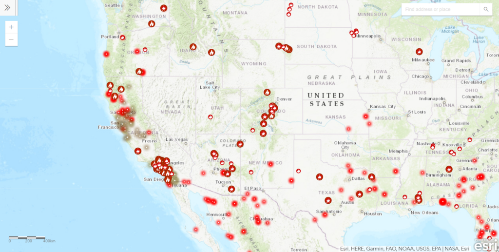
Source: Frontline Wildfire
By using real-time location data, governments can improve public safety planning, ensuring that resources and interventions are allocated where they are needed most.
Transportation Planning
Transportation planning greatly benefits from mobility location data, particularly when addressing traffic congestion and optimizing public transport routes.
By analyzing real-time traffic flow, transportation authorities can pinpoint congestion hotspots and find alternative routes to minimize delays, improving the overall commuter experience.
This data can also guide infrastructure development, such as building new roads or expanding public transport in high-demand areas.
With the mobility data gathered, city authorities can:
- Optimize bus and train schedules
- Improve pedestrian safety
- Promote environmentally friendly transport options like biking or walking
By tracking movement patterns, authorities can prioritize projects that will most effectively reduce traffic congestion, improve air quality, and make travel easier for residents.
Experience the Power of Localized Insights with dataplor
Mobility location data is a game changer for both businesses and public sector initiatives, enabling localized strategies that deliver tangible results.
With high-quality location intelligence, organizations can unlock opportunities, optimize operations, and create solutions to meet the changing needs of their audience.
At dataplor, we provide comprehensive, reliable datasets so you can make informed decisions. Our data is tailored to a wide variety of industries and sectors, offering unmatched granularity and coverage.
With dataplor, you can say goodbye to lengthy data collection processes, seamlessly integrate our datasets into your existing systems, and process data your way to get the insights you need most.
Benefit from:
- High-Quality Data: Complete and accurate datasets for diverse use cases.
- Custom Data Feeds: Get the data you need, in the format that suits you best.
- Unbeatable Support: Our team will give you the tools and guidance to help you maximize your data’s potential.
Ready to buy location data from a data provider and supercharge your localized strategies, saying no to irrelevant third-party data sources?
Talk to an expert today or request a free data sample to experience our services and see how we compare to other data providers.
So, what are you waiting for?
Get in touch with dataplor today and start unlocking precise, actionable insights to achieve your objectives.